Mont Facciabella, from Mandriou

Edited by:
Massimo Martini
Updated at: 13/08/2026
Access
Road directions
Leave the A5 motorway at the Verrès toll booth (toll section) and continue for 38 metres (0.04 km) towards the roundabout. At the roundabout, take the second exit and follow Via Caduti della Libertà/SR45 for 300 metres (0.34 km). Turn left onto Via Canonici Regolari Lateranensi/SR45 and continue for 3.5 km (3.84 km). Continue along the SR45 for 18.5 km (22.34 km), travelling up the valley and passing through the villages of Challand-Saint-Victor, Challand-Saint-Anselme, Brusson, Vollon and Extrapieraz, until you reach the junction for Antagnod in the hamlet of Corbet. Turn left onto Frazione Corbet for 210 m (22.55 km), then continue along Frazione Trochey and Meytere for 400 m (22.95 km). Continue along the SR4 for 1.4 km (24.35 km), then along Route Monsignore Obert for 350m (24.70km) and along Boulevard des Sabotiers for 700m (25.40km), which curves slightly to the left to become Route Emilio Chanoux: continue for 1.3km (26.70km). Keep to the left and continue along Route de Mandriou for 1.7 km (28.40 km) until you reach the car park, situated just before the village.
Car park
In Mandriou there is a free 🅿️ car park situated just before the village, along Route de Mandriou. If the car park is full, you can park along the road, taking care not to obstruct traffic.
Access by public transport
Mandriou is not directly served by public transport. During the summer, a circular shuttle service 🚌 operated by VITA is available (blue shuttle – Champoluc – Antagnod – Corbet), which connects to Magneaz. From there, you can reach Mandriou on foot via a footpath, with an additional 130-metre climb and a distance of 700 metres further than the routes starting directly from Mandriou.
Distance and journey time
🕒 Journey time: 45 minutes
📏 Distance: 28.40 km
GPS navigation
Information notice
The directions provided were verified on the date the route was mapped. Before setting off, it is advisable to check for any changes to the route. For up-to-date and detailed directions, we recommend using Google Maps or Apple Maps.
Introduction
A climb that starts from the village of Mandriou and ascends the upper Val d’Ayas to Mont Facciabella, following for much of the way the same route that leads to theAlpe Métsan and the Sarteur Chapel, before branching off from it on the final stretch towards the summit ridge.
The route passes through a variety of landscapes: the larch forest overlooking Mandriou, the Ru Courtod – a historic irrigation channel bearing witness to theAosta Valley’s ancient hydraulic engineering, the mountain pastures of Métsan (home to the La Tchavana farm holiday accommodation) and Vascoccia, and the Sarteur Chapel, a nineteenth-century building now dedicated to Our Lady of the Snows. Once past Colle Vascotchaz, the route continues along an easy ridge, with views of the Italian side of Monte Rosa and the peaks of Petit and Grand Tournalin, up to the gently sloping summit of Facciabella.
The best time to visit is July, when the mountain pastures crossed during the first part of the route are in full bloom. The overall difficulty is that of a hike (T2); the only section requiring caution is the final stretch, between Colle Vascotchaz and the summit, where the path disappears several times amongst the rocks and you must rely on the yellow markings painted on the rock slabs along the ridge line to find your way.
Description
0h00' 0.00 km From the car park, keep the Chapel of the Immaculate Conception on your right and take the narrow road towards the village. Near the drinking fountain 💧 you’ll find signposts indicating the route to Lac Lochien and other local trails. Follow the marked trail, winding your way through the characteristic stone buildings of the village of Mandriou. Once past the last houses, the path becomes steeper, runs alongside a wayside shrine and reaches the access road to Cà Zena (1,883 m). Ignore the road and carry on straight along the path, which leaves the pasture and enters a sparse larch forest. Continue in the same direction on a steady incline until you reach the first clearing. Carry on for a few more minutes until you come to a signpost at an altitude of 1,950 m, which confirms the direction to Lac Lochien.
0h20' 0.58 km
Continue straight along the main path, keeping to the route without any detours until you reach the Ru Courtod, a clearly visible open irrigation channel that runs alongside the hillside at a gentle gradient.
You will soon reach an information board situated near the canal, where the route crosses the course of the Ru (1,976m): follow the main track, taking care not to be distracted by the side paths. From this point, you can observe the structure of the Ru at close quarters, a historical testament to the ancient hydraulic engineering of the Aosta Valley, once used for the distribution of water for agricultural purposes.
0h24' 0.77km Cross the Ru Courtod via a small wooden bridge, continuing the ascent towards theAlpe Metsan (or Mezzan), home to the La Tchavana farm holiday accommodation. Once you reach the mountain pasture (2,012m), where there is a final drinking fountain 💧, cross the road coming from the right, pass thepicnic area with a small lake and begin an uphill traverse to the left towards the Sarteur Chapel. The traverse, which is of a steady gradient and presents no difficulties, takes 20–30 minutes. Once you reach the side of the chapel, leave it on your right without reaching it and continue almost straight on, passing Alpe Vascoccia and walking past it. The path disappears into the pasture for a few dozen metres: head towards the mountain pasture, which is clearly visible, and you will briefly find yourself on the road leading up to it from the valley. Skirt the road and leave it immediately, continuing along path , which initially heads towards Colle Vascothaz. You’ll come to a wooden sign indicating theindicating the altitude (2,280 m) and the Sentiero degli Alpini towards Falconetta, which continues to the left: ignore this and carry on straight ahead along the well-marked path , coming to a boulder with two painted trail markers a few metres further on.
[1h15’T2] 2.34 km (470 m elevation gain) The boulder points to the left towards the path to Falconetta (Bec de Nannaz) and straight ahead towards the path to Colle Vascothaz. Continue the ascent straight on along the , gradually gaining height amongst meadows and exposed rocks, sometimes in a straight line and sometimes with a few hairpin bends; the well-defined path has a few forks that rejoin a little further on. You will thus reach, in 30–50 minutes from theAlpe Vascoccia, the summit of Colle Vascothaz (2,568 m), from where you’ll first catch sight of the Petit Tournalin (3,207 m) and the Grand Tournalin (3,379 m). The path continues, cutting diagonally across the scree-covered eastern and north-eastern slopes of the Falconetta: leave it here to begin the ascent to Facciabella.
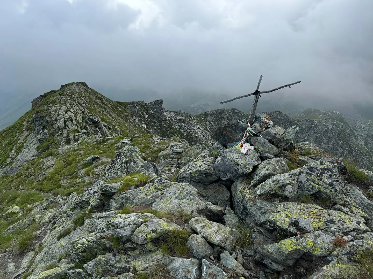
2h02' 3.79 km (761 m elevation gain) Immediately after crossing Colle Vascothaz, look out for a large boulder marked with two trail markers: the , which continues towards Colle di Nana, and the , which starts here and leads to the summit of Facciabella. Take the to the right, towards Monte Rosa, going round the grassy hummock just east of the pass. The trail on the ground disappears shortly afterwards, but simply follow the yellow arrows painted on rock slabs, positioned so as to remain visible; if these are missing, head for the ridge line and follow it. Reach the top of a small hump and descend into the next gully, then climb back up onto the ridge, where the path reappears. Continue towards the summit, staying on the ridge line where it is wide, and descend slightly down the southern slope in the sections where it becomes rocky, to avoid any difficulty. You will thus reach the vicinity of the summit: the path leads into the small cirque to the south-east of the summit, marked by a vertical post, but just before this a branch branches off to the left; follow it for a few metres until you reach the summit rocks of Mont Facciabella (2,621m) [2h17’T2] 4.19km .
The return journey follows the same route taken on the ascent [3h49’T2] 8.11 km (23 m elevation gain) (784 m elevation loss).
Comments (0)
Sign in to leave a comment